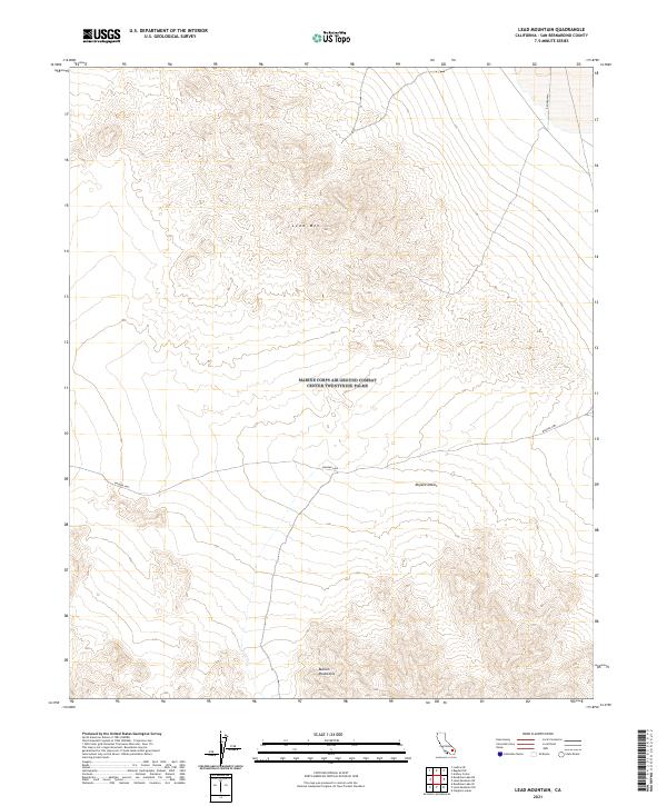
2021 Map of Lead Mountain
USGS Topo · Published 2021About this map
Lead Mtn rises as the central landmark within this portion of the Mojave Desert, anchoring a landscape defined by sharp topographic relief and arid basins. The map illustrates the northern reaches of the Bullion Mountains, which dominate the southern section of the quadrangle. A primary transit corridor is established by the Bagdad Hwy, cutting across the desert floor to connect remote regions of San Bernardino County. This 2021 update by the U.S. Geological Survey utilizes data from the National Elevation Dataset and GNIS to document the precise contours and survey boundaries of the Public Land Survey System, including several township and range divisions such as t5n r10e and t4n r10e. The map serves as a vital record of this high-desert terrain before further environmental or infrastructure changes occur.
Find a feature on this map
13 named features on this map. Tap any name to fly to it.
Don’t see what you’re looking for? This feature index may not catch every label — zoom into the map to look around manually.
Map Details
Editions of this 2021 Lead Mountain Map
This is the sole edition of this map. No revisions or reprints were ever made.
Other maps of this area

1942 · Amboy
USGS Topo · 1:250,000

1943 · Amboy
USGS Topo · 1:250,000

1953 · San Bernardino
USGS Topo · 1:250,000

1954 · Needles
USGS Topo · 1:250,000

1954 · Amboy Crater
USGS Topo · 1:24,000

1954 · Bagdad SW
USGS Topo · 1:24,000

1954 · Ludlow SE
USGS Topo · 1:24,000

1955 · Lead Mountain
USGS Topo · 1:24,000

1955 · Deadman Lake SE
USGS Topo · 1:24,000

1955 · Lead Mtn. NE
USGS Topo · 1:24,000