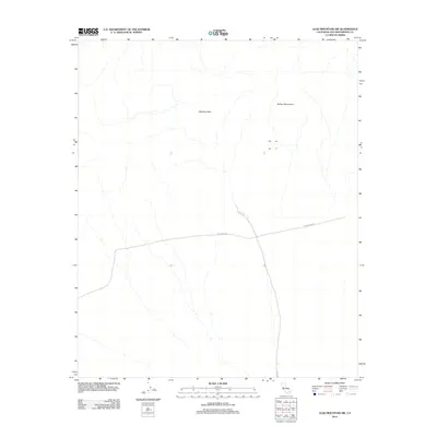
2012 Map of Lead Mountain SW
USGS Topo · Published 2012About this map
Bullion Mountains dominate the northeastern portion of this arid California landscape, providing a rugged backdrop to the expansive military and transit infrastructure in the high desert. The terrain is defined by the natural corridor of Cleghorn Pass, a significant topographical break in the mountain range that has historically influenced movement through this part of San Bernardino County. This 2012 survey illustrates the modern footprint of the 29 Palms MCAG, showing how military boundaries intersect with the sparse local road network. The presence of Steeg Rd serves as a primary artery through the desert floor, tracing a path that connects these remote geological features with the broader regional infrastructure. The map clearly delineates the sharp contrast between the untouched mountain peaks and the structured zones of the Marine Corps Air Ground Combat Center.
Find a feature on this map
5 named features on this map. Tap any name to fly to it.
Don’t see what you’re looking for? This feature index may not catch every label — zoom into the map to look around manually.
Map Details
Editions of this 2012 Lead Mountain SW Map
This is the sole edition of this map. No revisions or reprints were ever made.
Other maps of this area

1942 · Amboy
USGS Topo · 1:250,000

1943 · Amboy
USGS Topo · 1:250,000

1953 · San Bernardino
USGS Topo · 1:250,000

1954 · Needles
USGS Topo · 1:250,000

1954 · Valley Mtn
USGS Topo · 1:24,000

1955 · Lead Mountain
USGS Topo · 1:24,000

1955 · Deadman Lake SE
USGS Topo · 1:24,000

1955 · Lead Mtn. NE
USGS Topo · 1:24,000

1955 · Deadman Lake NE
USGS Topo · 1:24,000

1955 · Lead Mountain SW
USGS Topo · 1:24,000