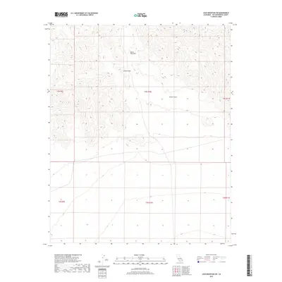
2018 Map of Lead Mountain SW
USGS Topo · Published 2018About this map
The Bullion Mountains dominate the northern landscape of this Mojave Desert region, defining the local topography with their jagged elevations and the natural transit point of Cleghorn Pass. Located within San Bernardino County, the terrain is characterized by the stark, arid stretches of the Mojave Desert, where the absence of established settlements or man-made infrastructure emphasizes the isolation of this high desert environment. The map provides a detailed view of the township and range boundaries, including t3n r10e and t2n r10e, which partition the open land into the systematic grid used for desert land management. For those interested in Western geography, the sheet illustrates the relationship between the elevated mountain ridges and the alluvial fans that spread toward the desert floor.
Find a feature on this map
9 named features on this map. Tap any name to fly to it.
Don’t see what you’re looking for? This feature index may not catch every label — zoom into the map to look around manually.
Map Details
Editions of this 2018 Lead Mountain SW Map
This is the sole edition of this map. No revisions or reprints were ever made.
Other maps of this area

1942 · Amboy
USGS Topo · 1:250,000

1943 · Amboy
USGS Topo · 1:250,000

1953 · San Bernardino
USGS Topo · 1:250,000

1954 · Needles
USGS Topo · 1:250,000

1954 · Valley Mtn
USGS Topo · 1:24,000

1955 · Lead Mountain
USGS Topo · 1:24,000

1955 · Deadman Lake SE
USGS Topo · 1:24,000

1955 · Lead Mtn. NE
USGS Topo · 1:24,000

1955 · Deadman Lake NE
USGS Topo · 1:24,000

1955 · Lead Mountain SW
USGS Topo · 1:24,000