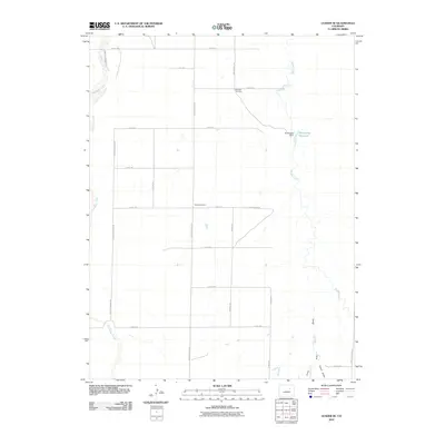
2010 Map of Leader SE
USGS Topo · Published 2010About this map
Woolsey Cemetery and the Busy Bee School sit amid the expansive agricultural grid of eastern Adams County, documenting the enduring community markers of this rural landscape. The terrain is defined by the parallel courses of East Bijou Creek to the west and Muddy Creek to the east, the latter of which is harnessed by the Bramkamp Dam to form the Bramkamp Reservoir. This section of the High Plains illustrates a transition where the managed water of the reservoir and the natural drainages of Lone Tree Gulch and Cabin Gulch meet the rigid geometry of section-line roads like Rector Leader Rd and Peoria Crossing Rd. The map provides a clear look at the sparse but vital infrastructure that sustained local life in the early 21st century.
Find a feature on this map
26 named features on this map. Tap any name to fly to it.
Don’t see what you’re looking for? This feature index may not catch every label — zoom into the map to look around manually.
Map Details
Editions of this 2010 Leader SE Map
This is the sole edition of this map. No revisions or reprints were ever made.
Other maps of this area

1951 · Leader NW
USGS Topo · 1:24,000

1951 · Leader SE
USGS Topo · 1:24,000

1951 · Leader
USGS Topo · 1:24,000

1952 · Leader SW
USGS Topo · 1:24,000

1953 · Denver
USGS Topo · 1:250,000

1954 · Limon
USGS Topo · 1:250,000

1956 · Peoria
USGS Topo · 1:24,000

1956 · Byers
USGS Topo · 1:24,000

1957 · Denver
USGS Topo · 1:250,000

1957 · Limon
USGS Topo · 1:250,000