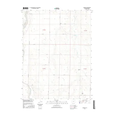
2016 Map of Leader SE
USGS Topo · Published 2016About this map
Woolsey Cem sits as a quiet landmark in the northern reaches of this Adams County landscape, a vital point for genealogists tracing family histories in the high plains. The terrain is defined by the winding course of Muddy Cr, which feeds into the Bramkamp Reservoir, and the deep incisions of Lone Tree Gulch and Cabin Gulch. This 2016 survey highlights a grid-based rural infrastructure where long-established thoroughfares like Peoria Crossing Rd and Hanks Crossing Rd cut across the drainage basins of the eastern Colorado plateau. The layout reflects a vast, agricultural character where section lines and local connectors like Mimosa Rd and Price Rd provide the primary framework for movement between isolated ranchlands and seasonal watercourses.
Find a feature on this map
26 named features on this map. Tap any name to fly to it.
Don’t see what you’re looking for? This feature index may not catch every label — zoom into the map to look around manually.
Map Details
Editions of this 2016 Leader SE Map
This is the sole edition of this map. No revisions or reprints were ever made.
Other maps of this area

1951 · Leader NW
USGS Topo · 1:24,000

1951 · Leader SE
USGS Topo · 1:24,000

1951 · Leader
USGS Topo · 1:24,000

1952 · Leader SW
USGS Topo · 1:24,000

1953 · Denver
USGS Topo · 1:250,000

1954 · Limon
USGS Topo · 1:250,000

1956 · Peoria
USGS Topo · 1:24,000

1956 · Byers
USGS Topo · 1:24,000

1957 · Denver
USGS Topo · 1:250,000

1957 · Limon
USGS Topo · 1:250,000