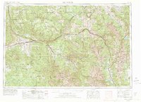
1957 Map of Leadville
USGS Topo · Published 1978About this map
The Sawatch Mountains and the high mining camps of the central Rockies are captured here in a period of transition as tourism began to reshape the old extractive economy. At the heart of the sheet, Leadville and neighboring Stringtown sit at the headwaters of the Arkansas River, flanked by the massive peaks of Mount Elbert and Mount Massive. The map traces the critical corridor of the Colorado River and the Denver and Rio Grande Western RR, which connects riverside towns like Glenwood Springs, Eagle, and Gypsum.
Find a feature on this map
76 named features on this map. Tap any name to fly to it.
Don’t see what you’re looking for? This feature index may not catch every label — zoom into the map to look around manually.
Map Details
Editions of this 1957 Leadville Map
2 editions found

Other maps of this area

1888 · Crested Butte
USGS Topo · 1:62,500

1888 · Anthracite
USGS Topo · 1:62,500

1889 · Crested Butte
USGS Topo · 1:62,500

1889 · Anthracite
USGS Topo · 1:62,500

1889 · Leadville
USGS Topo · 1:125,000

1891 · Leadville
USGS Topo · 1:125,000

1893 · Anthracite
USGS Topo · 1:62,500

1893 · Crested Butte
USGS Topo · 1:62,500

1893 · Aspen
USGS Topo · 1:62,500

1894 · Anthracite
USGS Topo · 1:62,500