
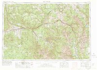
1957 Map of Leadville
USGS Topo · Published 1978About this map
Mount Elbert and Mt Massive dominate the eastern half of this terrain, marking the high crest of the Sawatch Mountains during a period of significant recreational and industrial transition. The map captures the high-altitude mining landscapes around Leadville and the precarious mountain settlements of Gilman and Climax, where extraction remained a primary economic driver. Transit follows the winding path of the Denver and Rio Grande Western RR as it threads through the Eagle River canyon and connects the western slope communities of Glenwood Springs and Rifle. To the west, the massive uplift of the Grand Hogback and the protected reaches of the Flat Tops Wilderness illustrate the contrast between the developed river corridors and the expansive forest lands. This 1970s-era revision provides a clear record of the region's hydrography, including Twin Lakes Reservoir and the Dillon Res, showing the evolving management of the high Colorado headwaters.
Find a feature on this map
100 named features on this map. Tap any name to fly to it.
Don’t see what you’re looking for? This feature index may not catch every label — zoom into the map to look around manually.
Map Details
Editions of this 1957 Leadville Map
2 editions found
Other maps of this area

1888 · Crested Butte
USGS Topo · 1:62,500

1888 · Anthracite
USGS Topo · 1:62,500

1889 · Crested Butte
USGS Topo · 1:62,500

1889 · Anthracite
USGS Topo · 1:62,500

1889 · Leadville
USGS Topo · 1:125,000

1891 · Leadville
USGS Topo · 1:125,000

1893 · Anthracite
USGS Topo · 1:62,500

1893 · Crested Butte
USGS Topo · 1:62,500

1893 · Aspen
USGS Topo · 1:62,500

1894 · Anthracite
USGS Topo · 1:62,500