
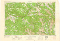
1960 Map of Leadville
USGS Topo · Published 1960About this map
Leadville sits at the heart of this high-altitude landscape, serving as a hub for the region's mining and transit during the mid-20th century. The map documents a critical period of Colorado history, featuring the Climax Molybdenum Mine near the headwaters of the Eagle River. The transportation network is dominated by the Denver and Rio Grande Western RR, which follows the steep valleys of the Colorado River and the Roaring Fork River, connecting towns like Glenwood Springs and Aspen.
Find a feature on this map
128 named features on this map. Tap any name to fly to it.
Don’t see what you’re looking for? This feature index may not catch every label — zoom into the map to look around manually.
Map Details
Editions of this 1960 Leadville Map
2 editions found
Other maps of this area

1888 · Crested Butte
USGS Topo · 1:62,500

1888 · Anthracite
USGS Topo · 1:62,500

1889 · Crested Butte
USGS Topo · 1:62,500

1889 · Anthracite
USGS Topo · 1:62,500

1889 · Leadville
USGS Topo · 1:125,000

1891 · Leadville
USGS Topo · 1:125,000

1893 · Anthracite
USGS Topo · 1:62,500

1893 · Crested Butte
USGS Topo · 1:62,500

1893 · Aspen
USGS Topo · 1:62,500

1894 · Anthracite
USGS Topo · 1:62,500