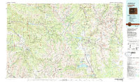
1983 Map of Leadville
USGS Topo · Published 1983About this map
Leadville stands as a focal point of this 1983 study, situated between the high peaks of the Sawatch Range and the Mosquito Range. The map documents the industrial landscape of the early 1980s, dominated by the massive footprint of the Climax Mine and the Sherman Mine. In the valley, the Arkansas River flows past Stringtown, Malta, and the Federal Fish Hatchery, while the Denver and Rio Grande Western railroad line tracks along the riverbank. This edition captures the expansion of resort and educational infrastructure, showing Snowmass Village and Aspen in the west, and the campus of Colorado Mountain College in the east. Beyond the towns, the terrain is defined by some of the state's highest summits, including Mount Elbert and Mount Massive, surrounded by the protected expanses of the White River National Forest and the San Isabel National Forest.
Find a feature on this map
62 named features on this map. Tap any name to fly to it.
Don’t see what you’re looking for? This feature index may not catch every label — zoom into the map to look around manually.
Map Details
Editions of this 1983 Leadville Map
2 editions found
Other maps of this area

1888 · Crested Butte
USGS Topo · 1:62,500

1888 · Anthracite
USGS Topo · 1:62,500

1889 · Crested Butte
USGS Topo · 1:62,500

1889 · Anthracite
USGS Topo · 1:62,500

1889 · Leadville
USGS Topo · 1:125,000

1891 · Leadville
USGS Topo · 1:125,000

1893 · Anthracite
USGS Topo · 1:62,500

1893 · Crested Butte
USGS Topo · 1:62,500

1893 · Aspen
USGS Topo · 1:62,500

1894 · Anthracite
USGS Topo · 1:62,500