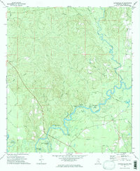
1973 Map of Leakesville SW
USGS Topo · Published 1975About this map
The Chickasawhay River and Leaf R converge in this corner of Greene County, creating a landscape defined by dramatic bends and numerous oxbow lakes. Water features like Cowans Dead River, Dressler Hammond Dead River, and Battlesnake Lake trace the ancestral paths of these shifting waterways. High ground is marked by landmarks such as Roberts Bluff and Shell Bluff, while the regional economy is represented by a Sandpit and a modern Pipeline cutting across the terrain.
Find a feature on this map
36 named features on this map. Tap any name to fly to it.
Don’t see what you’re looking for? This feature index may not catch every label — zoom into the map to look around manually.
Map Details
Editions of this 1973 Leakesville SW Map
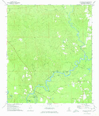
2 editions found
Other maps of this area

1941 · Lucedale
USGS Topo · 1:62,500

1943 · Lucedale
USGS Topo · 1:62,500

1947 · Beaumont
USGS Topo · 1:62,500

1947 · Benndale
USGS Topo · 1:62,500

1949 · Beaumont
USGS Topo · 1:62,500

1949 · Benndale
USGS Topo · 1:62,500

1953 · Hattiesburg
USGS Topo · 1:250,000

1953 · Mobile
USGS Topo · 1:250,000

1957 · Mobile
USGS Topo · 1:250,000

1958 · Hattiesburg
USGS Topo · 1:250,000