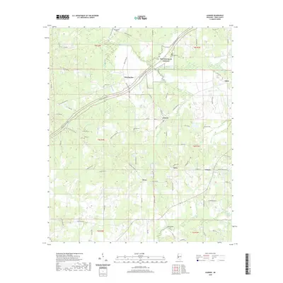
2020 Map of Learned
USGS Topo · Published 2020About this map
Learned and the surrounding rural landscape of Hinds County are bisected by the Natchez Trace Parkway, which follows the historic path of the old frontier road. This 2020 map documents a distribution of small communities and family landmarks, including Salem, Adams, and Morning Star. The terrain is defined by a dense network of meandering watercourses, most notably Fourteenmile Creek and Tallahalla Creek, which drain the wooded bottoms. Numerous burial sites such as Auburn Cem and Nalley Cem are situated throughout the area, often near historic crossroads and rural churches like Salem. This modern survey provides a detailed record of local infrastructure, from the Roach Bridge over the Tallahalla to the various farm roads and lanes that connect these long-standing Mississippi settlements.
Find a feature on this map
85 named features on this map. Tap any name to fly to it.
Don’t see what you’re looking for? This feature index may not catch every label — zoom into the map to look around manually.
Map Details
Editions of this 2020 Learned Map
This is the sole edition of this map. No revisions or reprints were ever made.
Other maps of this area

1903 · Jackson
USGS Topo · 1:125,000

1934 · Raymond
USGS Topo · 1:48,000

1937 · Raymond
USGS Topo · 1:62,500

1937 · Terry
USGS Topo · 1:48,000

1938 · Edwards
USGS Topo · 1:62,500

1942 · Raymond
USGS Topo · 1:62,500

1943 · Terry
USGS Topo · 1:62,500

1955 · Jackson
USGS Topo · 1:250,000

1961 · Jackson
USGS Topo · 1:250,000

1962 · Jackson
USGS Topo · 1:250,000