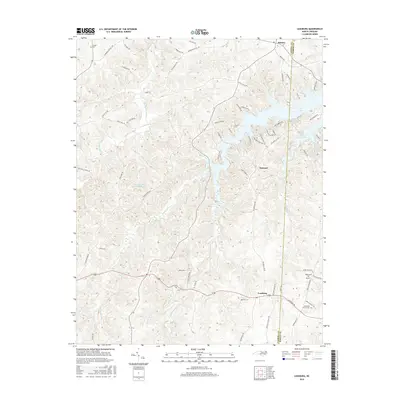
2016 Map of Leasburg
USGS Topo · Published 2016About this map
Leasburg and the surrounding tobacco country of Caswell County are defined by the winding waters of Hyco Creek and its many tributaries. The landscape is a network of rural routes named for local families and agricultural sites, such as Yarbroughs Mill Rd, Murphy Rd, and Slaughter Rd. The northern portion of the map is dominated by the sprawling reaches of Hyco Lake, where the Caswell Co Person Co line intersects the water near Semora. This modern survey reveals the shift toward recreation and conservation in the region, evidenced by the numerous residential developments like Pine Knoll Acres and the protected lands of the Caswell Wildlife Mgmt Area Pond 1. Small inland settlements like Gilead and Osmond anchor the interior, while sites like Ebenezer Church and the Winstead 76 Airport mark the community centers and infrastructure of the contemporary era.
Find a feature on this map
70 named features on this map. Tap any name to fly to it.
Don’t see what you’re looking for? This feature index may not catch every label — zoom into the map to look around manually.
Map Details
Editions of this 2016 Leasburg Map
This is the sole edition of this map. No revisions or reprints were ever made.
Other maps of this area

1923 · Danville
USGS Topo · 1:48,000

1925 · Danville
USGS Topo · 1:62,500

1952 · Milton
USGS Topo · 1:62,500

1953 · Greensboro
USGS Topo · 1:250,000

1954 · Greensboro
USGS Topo · 1:250,000

1956 · Milton
USGS Topo · 1:62,500

1962 · Greensboro
USGS Topo · 1:250,000

1965 · Ringgold
USGS Topo · 1:24,000

1966 · Greensboro
USGS Topo · 1:250,000

1968 · Leasburg
USGS Topo · 1:24,000