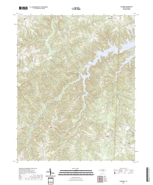
2022 Map of Leasburg
USGS Topo · Published 2022About this map
The settlement of Leasburg anchors the southern portion of this Caswell County landscape, situated near the headwaters of Hyco Creek. Further north, the massive impoundment of the Hyco River dominates the terrain, creating a complex shoreline that defines much of the area around Osmond and Semora. This map illustrates the intersection of traditional agricultural roots and modern infrastructure, where family-named roads like Yarbroughs Mill Rd and Beau Matthews Farm Rd crisscross a topography defined by significant waterways like Country Line Creek and Reedy Fork. For those tracing local heritage, the map identifies specific landmarks such as Gilead Cem and Ebenezer Church Cem, alongside the small-scale aviation footprint of Winstead 76 Airport near the border of Person County. The intricate network of residential lanes and local roads reflects the rural residential character that has evolved along the river's edge.
Find a feature on this map
70 named features on this map. Tap any name to fly to it.
Don’t see what you’re looking for? This feature index may not catch every label — zoom into the map to look around manually.
Map Details
Editions of this 2022 Leasburg Map
This is the sole edition of this map. No revisions or reprints were ever made.
Other maps of this area

1923 · Danville
USGS Topo · 1:48,000

1925 · Danville
USGS Topo · 1:62,500

1952 · Milton
USGS Topo · 1:62,500

1953 · Greensboro
USGS Topo · 1:250,000

1954 · Greensboro
USGS Topo · 1:250,000

1956 · Milton
USGS Topo · 1:62,500

1962 · Greensboro
USGS Topo · 1:250,000

1965 · Ringgold
USGS Topo · 1:24,000

1966 · Greensboro
USGS Topo · 1:250,000

1968 · Leasburg
USGS Topo · 1:24,000