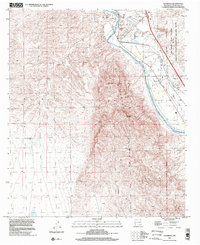
1996 Map of Leasburg
USGS Topo · Published 2002About this map
Fort Selden State Monument and the ruins of Fort Selden occupy a strategic position overlooking the Rio Grande as it enters the Mesilla Valley. By the late 20th century, this area of the Rincon Valley was defined by sophisticated water management systems, including the Leasburg Dam, the Leasburg Canal, and the American Canal Drain. These structures facilitated agriculture alongside the Atchison Topeka and Santa Fe railroad line. The map captures the sharp contrast between the irrigated valley floor and the arid peaks of the Robledo Mountains, where Lookout Peak and Robledo Mountain dominate the skyline. In the northeast, the New Mexico State University Chihuahuan Desert Rangeland Research Center marks a significant institutional presence in the desert landscape near Radium Springs and the small settlement of Leasburg.
Find a feature on this map
30 named features on this map. Tap any name to fly to it.
Don’t see what you’re looking for? This feature index may not catch every label — zoom into the map to look around manually.
Map Details
Editions of this 1996 Leasburg Map
This is the sole edition of this map. No revisions or reprints were ever made.
Other maps of this area

1891 · Las Cruces
USGS Topo · 1:125,000

1893 · Las Cruces
USGS Topo · 1:125,000

1916 · Tonuco
USGS Topo · 1:125,000

1932 · Tonuco
USGS Topo · 1:125,000

1941 · Las Cruces
USGS Topo · 1:62,500

1943 · Corralitos Ranch
USGS Topo · 1:62,500

1943 · Las Cruces
USGS Topo · 1:62,500

1948 · San Diego Mountain
USGS Topo · 1:62,500

1955 · Las Cruces
USGS Topo · 1:250,000

1958 · Las Cruces
USGS Topo · 1:250,000