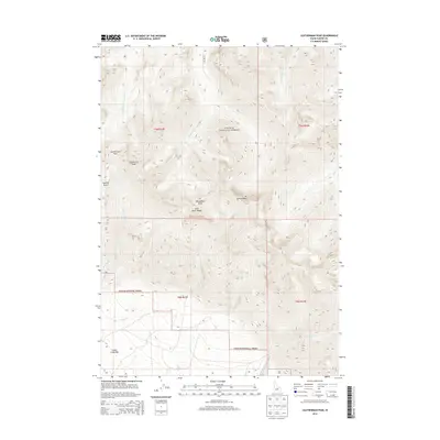
2013 Map of Leatherman Peak
USGS Topo · Published 2013About this map
Leatherman Peak and the high summits of the Lost River Range dominate this 2013 survey of the Challis National Forest. The map documents a stark alpine landscape defined by massive relief, where drainage systems like the W Fork Pahsimeroi River and E Fork Pahsimeroi River flow north from the heights. High-altitude points such as Mt Breitenbach and Donaldson Peak mark the crest of the range, while Leatherman Pass provides a traditional transition through the steep terrain. Human footprints are sparse but significant, centered on the lower elevations at Cedar Creek Bar. This map is particularly useful for geologists and backcountry historians interested in the drainage patterns of Lone Cedar Cr, Pete Cr, and Upper Cedar Cr as they emerge from the mountain front.
Find a feature on this map
20 named features on this map. Tap any name to fly to it.
Don’t see what you’re looking for? This feature index may not catch every label — zoom into the map to look around manually.
Map Details
Editions of this 2013 Leatherman Peak Map
This is the sole edition of this map. No revisions or reprints were ever made.
Other maps of this area

1935 · MacKay
USGS Topo · 1:96,000

1935 · Borah Peak
USGS Topo · 1:125,000

1938 · Borah Peak
USGS Topo · 1:125,000

1940 · Mackay
USGS Topo · 1:62,500

1955 · Dubois
USGS Topo · 1:250,000

1955 · Idaho Falls
USGS Topo · 1:250,000

1958 · Dubois
USGS Topo · 1:250,000

1958 · Idaho Falls
USGS Topo · 1:250,000

1960 · Mackay
USGS Topo · 1:62,500

1960 · Copper Basin
USGS Topo · 1:62,500