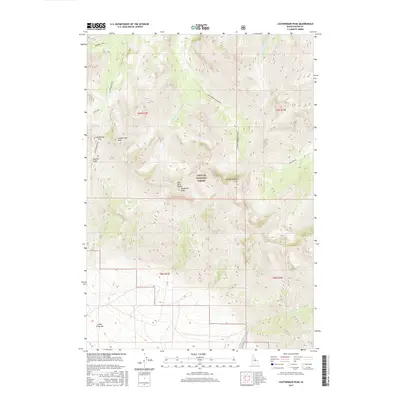
2017 Map of Leatherman Peak
USGS Topo · Published 2017About this map
Leatherman Peak and the surrounding high-altitude terrain of the Lost River Range dominate this portion of the Challis National Forest in Custer County. The map documents a watershed divide where the headwaters of the W Fork Pahsimeroi River and E Fork Pahsimeroi River begin their descent. To the south and east, drainage patterns shift toward the Lone Cedar Cr and Upper Cedar Cr systems. The landscape is characterized by significant topographical features such as Donaldson Peak and Mt Breitenbach, alongside alpine water bodies like Merriam Lake and Pass Lake. In the lower elevations, the Cedar Creek Bar and Sawmill Gulch suggest historical land use patterns and access points into these remote mountain reaches. This survey provides a precise look at the 2017 trail and drainage network before any more recent environmental or management changes.
Find a feature on this map
24 named features on this map. Tap any name to fly to it.
Don’t see what you’re looking for? This feature index may not catch every label — zoom into the map to look around manually.
Map Details
Editions of this 2017 Leatherman Peak Map
This is the sole edition of this map. No revisions or reprints were ever made.
Other maps of this area

1935 · MacKay
USGS Topo · 1:96,000

1935 · Borah Peak
USGS Topo · 1:125,000

1938 · Borah Peak
USGS Topo · 1:125,000

1940 · Mackay
USGS Topo · 1:62,500

1955 · Dubois
USGS Topo · 1:250,000

1955 · Idaho Falls
USGS Topo · 1:250,000

1958 · Dubois
USGS Topo · 1:250,000

1958 · Idaho Falls
USGS Topo · 1:250,000

1960 · Mackay
USGS Topo · 1:62,500

1960 · Copper Basin
USGS Topo · 1:62,500