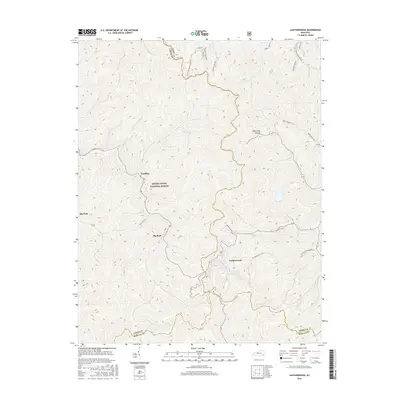
2016 Map of Leatherwood
USGS Topo · Published 2016About this map
Daniel Boone National Forest covers much of the central and western portion of this 2016 survey, a landscape defined by the steep, narrow drainages and ridge-running boundaries of southeastern Kentucky. The convergence of Leslie, Perry, and Harlan counties occurs here, with the terrain dictating the placement of small communities like Leatherwood and Yeaddiss. Settlement patterns follow the winding creek beds and narrow hollows, evidenced by a dense network of local routes including Stratton Fork Rd and Right Fork Maces Creek Rd. The map documents the local geography of the Cumberland Plateau, where place names such as Hogtrough Hollow and Beegum Curve reflect the vernacular history and topographical challenges of the coal-country interior.
Find a feature on this map
24 named features on this map. Tap any name to fly to it.
Don’t see what you’re looking for? This feature index may not catch every label — zoom into the map to look around manually.
Map Details
Editions of this 2016 Leatherwood Map
This is the sole edition of this map. No revisions or reprints were ever made.
Other maps of this area

1887 · Jonesville
USGS Topo · 1:125,000

1891 · Hazard
USGS Topo · 1:125,000

1891 · Jonesville
USGS Topo · 1:125,000

1903 · Harlan
USGS Topo · 1:48,000

1916 · Cornettsville
USGS Topo · 1:62,500

1916 · Harlan
USGS Topo · 1:48,000

1916 · Nolansburg
USGS Topo · 1:48,000

1916 · Hyden
USGS Topo · 1:48,000

1919 · Nolansburg
USGS Topo · 1:62,500

1919 · Hyden
USGS Topo · 1:62,500