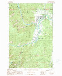
1989 Map of Leavenworth
USGS Topo · Published 1989About this map
The Wenatchee River winds through the heart of this landscape, emerging from the steep Tumwater Canyon and flowing past the town of Leavenworth. By the late 1980s, the area reflects a transition from traditional resource management to recreation and conservation, with Ski Trails and a Golf Course visible alongside industrial landmarks like the Leavenworth National Fish Hatchery. The map highlights the complex relationship between the built environment and the surrounding wilderness, including the Alpine Lakes Wilderness and Wenatchee National Forest.
Find a feature on this map
38 named features on this map. Tap any name to fly to it.
Don’t see what you’re looking for? This feature index may not catch every label — zoom into the map to look around manually.
Map Details
Editions of this 1989 Leavenworth Map
3 editions found
Other maps of this area

1897 · Mount Stuart
USGS Topo · 1:125,000

1901 · Chiwaukum
USGS Topo · 1:125,000

1902 · Mount Stuart
USGS Topo · 1:125,000

1904 · Chiwaukum
USGS Topo · 1:125,000

1957 · Wenatchee
USGS Topo · 1:250,000

1961 · Liberty
USGS Topo · 1:62,500

1961 · Mount Stuart
USGS Topo · 1:62,500

1964 · Leavenworth
USGS Topo · 1:62,500

1965 · Chiwaukum Mts
USGS Topo · 1:62,500

1975 · Wenatchee
USGS Topo · 1:100,000