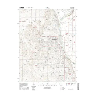
2015 Map of Leavenworth
USGS Topo · Published 2015About this map
The Missouri River serves as the dividing line between Kansas and Missouri, carving through a landscape defined by significant military and institutional footprints. On the Kansas side, Leavenworth and Lansing anchor a dense network of streets and institutional grounds, including the historic United States Penitentiary in Leavenworth Cem and the Univ of Saint Mary. The terrain is marked by prominent high points such as Pilot Knob and Hancock Hill, which overlook the river valley and the Sherman Army Airfield to the north.
Find a feature on this map
85 named features on this map. Tap any name to fly to it.
Don’t see what you’re looking for? This feature index may not catch every label — zoom into the map to look around manually.
Map Details
Editions of this 2015 Leavenworth Map
This is the sole edition of this map. No revisions or reprints were ever made.
Other maps of this area

1886 · Oskaloosa
USGS Topo · 1:125,000

1888 · Oskaloosa
USGS Topo · 1:125,000

1890 · Kansas City
USGS Topo · 1:125,000

1894 · Kansas City
USGS Topo · 1:125,000

1894 · Oskaloosa
USGS Topo · 1:125,000

1910 · Leavenworth
USGS Topo · 1:62,500

1934 · Bonner Springs
USGS Topo · 1:48,000

1934 · Wolcott
USGS Topo · 1:24,000

1940 · Bonner Springs
USGS Topo · 1:62,500
1948 · Wolcott
USGS Topo · 1:24,000