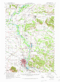
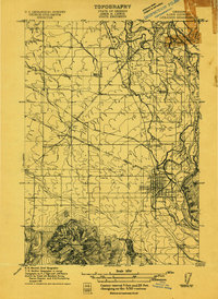
1957 Map of Lebanon
USGS Topo · Published 1980About this map
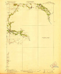
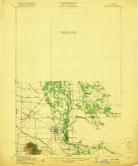
The South Santiam River flows through the heart of Linn County, shaping a landscape defined by its river-and-rail economy in the late 1950s. The bustling city of Lebanon serves as the primary hub, where the Southern Pacific and Oregon Electric lines converge near the Lebanon Airport. To the north, the smaller community of Scio sits along Thomas Creek, surrounded by timbered hills and fertile bottoms like McKinney Bottom. This era reflects a post-war rural infrastructure still heavily reliant on localized services, evidenced by a dense network of country schools such as Tennessee School and Denny School.
Find a feature on this map
95 named features on this map. Tap any name to fly to it.
Don’t see what you’re looking for? This feature index may not catch every label — zoom into the map to look around manually.
Map Details
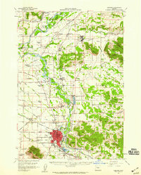
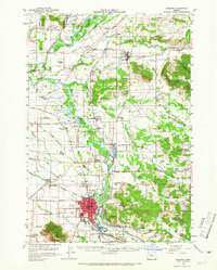
Editions of this 1957 Lebanon Map
3 editions found
Other maps of this area
1911 · Brownsville
USGS Topo · 1:31,680
1911 · Lebanon
USGS Topo · 1:31,680

1911 · Tangent
USGS Topo · 1:31,680

1912 · Jefferson
USGS Topo · 1:31,680

1912 · Halsey
USGS Topo · 1:62,500

1915 · Sidney
USGS Topo · 1:31,680

1916 · Albany
USGS Topo · 1:62,500

1917 · Salem
USGS Topo · 1:62,500
1921 · Brownsville
USGS Topo · 1:62,500
1921 · Lebanon
USGS Topo · 1:62,500