1976 Map of Lebanon
USGS Topo · Published 1981About this map
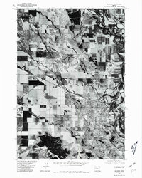
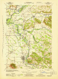
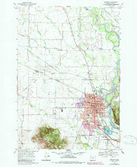
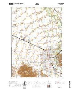
Lebanon sits prominently on the eastern side of this 1976 orthophotoquad, showing a detailed aerial view of the town's residential and industrial layout during the mid-1970s. The agricultural landscape to the west is heavily defined by the meandering path of Burkhart Creek and the broad floodplains of the South Santiam River, which winds through the northeastern corner of the map. The integration of aerial photography with traditional survey data by the Soil Conservation Service provides a clear look at land use patterns and field boundaries. To the south, the settlement of Crowfoot marks a distinct transition point near the base of Peterson Butte, a prominent geographic feature that dominates the southwestern quadrant. This map captures the region before more recent suburban expansion, preserving the mid-century relationship between the valley floor's irrigation networks and the growing urban center.
Find a feature on this map
5 named features on this map. Tap any name to fly to it.
Don’t see what you’re looking for? This feature index may not catch every label — zoom into the map to look around manually.
Map Details
Editions of this 1976 Lebanon Map
This is the sole edition of this map. No revisions or reprints were ever made.
Historical Maps of Lebanon Through Time
14 maps found
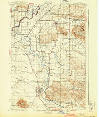
1911 Lebanon
Linn County, OR
1921 Lebanon
Linn County, OR
1922 Lebanon
Linn County, OR
1924 Lebanon
Linn County, OR
1940 Lebanon
Linn County, OR
1944 Lebanon
Linn County, OR
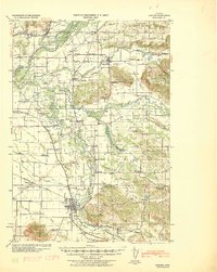
1957 Lebanon
Linn County, OR
1969 Lebanon
Linn County, OR
1976 Lebanon
Linn County, OR
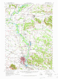
2011 Lebanon
Linn County, OR
2014 Lebanon
Linn County, OR
2017 Lebanon
Linn County, OR
2020 Lebanon
Linn County, OR
2024 Lebanon
Linn County, OR