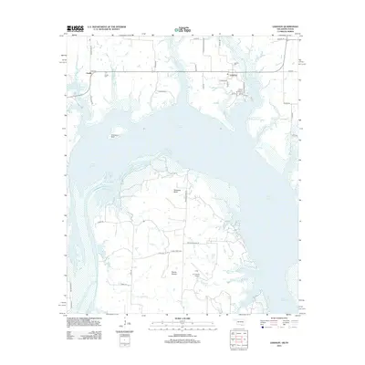
2012 Map of Lebanon
USGS Topo · Published 2012About this map
Lake Texoma dominates this region along the Oklahoma-Texas border, where the flooding of the Red River valley created a complex shoreline of inlets and peninsulas. The settlements of Lebanon and Enville sit on the northern heights, serving as anchor points for local history with the Lebanon Cem and Enville Cem preserved nearby. To the south, the prominent landform of Delaware Bend extends into the reservoir, characterized by a network of drainage features like Slickum Slough and Jenny Cr. This landscape reflects the intersection of cattle ranching and recreational geography, noted by the presence of the U U Ranch Airport and the transition from traditional rangeland to the water's edge. Notable topographic landmarks such as Graveyard Bluff and Brushy Mound provide distinct reference points for those studying the physical evolution of Love County's river-basin terrain.
Find a feature on this map
48 named features on this map. Tap any name to fly to it.
Don’t see what you’re looking for? This feature index may not catch every label — zoom into the map to look around manually.
Map Details
Editions of this 2012 Lebanon Map
This is the sole edition of this map. No revisions or reprints were ever made.
Other maps of this area

1901 · Tishomingo
USGS Topo · 1:125,000

1901 · Ardmore
USGS Topo · 1:125,000

1901 · Denison
USGS Topo · 1:125,000

1902 · Gainesville
USGS Topo · 1:125,000

1918 · Ardmore
USGS Topo · 1:125,000

1943 · Gainesville
USGS Topo · 1:125,000

1954 · Sherman
USGS Topo · 1:250,000

1957 · Ardmore
USGS Topo · 1:250,000

1958 · Gordonville
USGS Topo · 1:62,500

1958 · Sherman
USGS Topo · 1:250,000