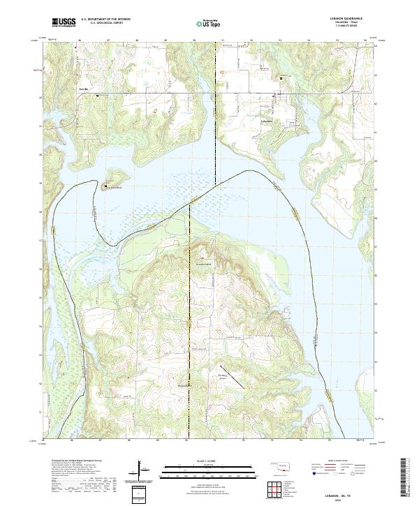
2022 Map of Lebanon
USGS Topo · Published 2022About this map
Red River currents define the boundary between Oklahoma and Texas, where the vast expanse of Lake Texoma dominates the central landscape. This survey of the Marshall County area captures the rural community of Lebanon north of the water, situated near the Lebanon Cem and a network of local roads like Lebanon Pool Rd and Red River Ave. To the west, the smaller settlement of Enville and its associated Enville Cem stand among the tributaries of Boggy Cr and Wilson Cr.
Find a feature on this map
60 named features on this map. Tap any name to fly to it.
Don’t see what you’re looking for? This feature index may not catch every label — zoom into the map to look around manually.
Map Details
Editions of this 2022 Lebanon Map
This is the sole edition of this map. No revisions or reprints were ever made.
Other maps of this area

1901 · Tishomingo
USGS Topo · 1:125,000

1901 · Ardmore
USGS Topo · 1:125,000

1901 · Denison
USGS Topo · 1:125,000

1902 · Gainesville
USGS Topo · 1:125,000

1918 · Ardmore
USGS Topo · 1:125,000

1943 · Gainesville
USGS Topo · 1:125,000

1954 · Sherman
USGS Topo · 1:250,000

1957 · Ardmore
USGS Topo · 1:250,000

1958 · Gordonville
USGS Topo · 1:62,500

1958 · Sherman
USGS Topo · 1:250,000