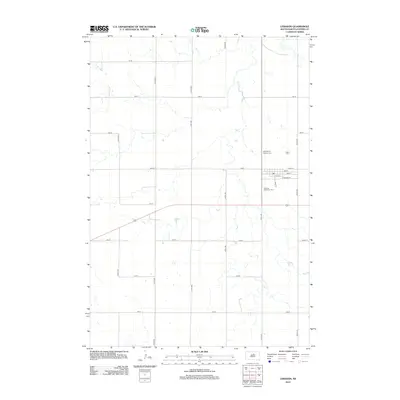
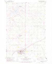
2012 Map of Lebanon
USGS Topo · Published 2012About this map
Lebanon centers this survey of Potter County, serving as a hub where the grid-work of the Great Plains meets the local road network. The small settlement is defined by a traditional street plan, including Main St and Railroad St, reflecting its origins as a transit point. To the north and south of the town core, the Saint Mary's Catholic Cem and Lebanon Protestant Cem provide significant landmarks for genealogists and local historians. The surrounding landscape is dominated by a systematic agricultural grid of numbered avenues and streets, such as 317th Ave and 160th St, which partition the prairie terrain. The absence of heavy industrial markings emphasizes the rural character of this region during the early twenty-first century, as the town maintains its role as a quiet community anchor in the Dakotas.
Find a feature on this map
27 named features on this map. Tap any name to fly to it.
Don’t see what you’re looking for? This feature index may not catch every label — zoom into the map to look around manually.
Map Details
Editions of this 2012 Lebanon Map
This is the sole edition of this map. No revisions or reprints were ever made.
Other maps of this area

1953 · Huron
USGS Topo · 1:250,000

1954 · Aberdeen
USGS Topo · 1:250,000

1954 · Huron
USGS Topo · 1:250,000

1956 · Aberdeen
USGS Topo · 1:250,000

1974 · Hoven
USGS Topo · 1:24,000
1974 · Flight Lake
USGS Topo · 1:24,000
1974 · Gettysburg Muni. Airport NE
USGS Topo · 1:24,000
1978 · Gettysburg Muni. Airport
USGS Topo · 1:24,000
1978 · Gettysburg
USGS Topo · 1:24,000

1978 · Seneca NW
USGS Topo · 1:24,000