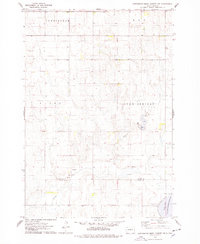
1974 Map of Gettysburg Muni. Airport NE
USGS Topo · Published 1978About this map
Okobojo Creek winds through this central South Dakota landscape, defining the topography across the borders of Potter County and Sully County. In the mid-1970s, this area was characterized by expansive townships such as Avon Springs, Elida, Cunningham, and Roy. A significant portion of the southeastern corner is occupied by the Stone Lake State Public Shooting Area, surrounding the waters of Stone Lake. Small-scale agricultural and infrastructure developments are evident through several scattered Gravel Pits and the presence of Potts Dam, which includes a designated Public Access point. The map reveals a sparsely populated prairie region where the section lines and natural drainage of the creek bed dictate the movement of roads and property boundaries.
Find a feature on this map
12 named features on this map. Tap any name to fly to it.
Don’t see what you’re looking for? This feature index may not catch every label — zoom into the map to look around manually.
Map Details
Editions of this 1974 Gettysburg Muni. Airport NE Map
This is the sole edition of this map. No revisions or reprints were ever made.
Other maps of this area

1953 · Huron
USGS Topo · 1:250,000

1954 · Aberdeen
USGS Topo · 1:250,000

1954 · Huron
USGS Topo · 1:250,000

1956 · Aberdeen
USGS Topo · 1:250,000

1974 · Gettysburg Municipal Airport SE
USGS Topo · 1:24,000
1974 · Gettysburg Municipal Airport SW
USGS Topo · 1:24,000
1978 · Gettysburg Muni. Airport
USGS Topo · 1:24,000
1978 · Gettysburg
USGS Topo · 1:24,000
1978 · Thomas Lake SW
USGS Topo · 1:24,000
1978 · Seneca SW
USGS Topo · 1:24,000