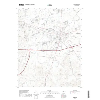
2019 Map of Lebanon
USGS Topo · Published 2019About this map
Lebanon serves as the focal point of this Wilson County study, showing the city's suburban expansion toward West End Heights and Egan. The landscape is defined by the rolling terrain of Seay Hill and Fourmile Hill, with numerous small family and community burial grounds like Eddins Cem, Hudson Cem, and Floyd Cem dotting the outskirts. This pattern of small, scattered cemeteries alongside modern infrastructure like the Lebanon Municipal Airport reflects the transition from a rural agricultural past to a growing regional hub. Hydrological features such as Sinking Creek and the W Fork Bartons Cr weave through the southern reaches of the quadrangle near the settlement of Holloway. The map provides a detailed view of the local road network connecting traditional neighborhoods with new developments along the major transit corridors.
Find a feature on this map
220 named features on this map. Tap any name to fly to it.
Don’t see what you’re looking for? This feature index may not catch every label — zoom into the map to look around manually.
Map Details
Editions of this 2019 Lebanon Map
This is the sole edition of this map. No revisions or reprints were ever made.
Other maps of this area

1942 · Statesville
USGS Topo · 1:100,000

1942 · Gallatin
USGS Topo · 1:100,000

1942 · Lebanon
USGS Topo · 1:100,000

1951 · Lebanon
USGS Topo · 1:24,000

1951 · Martha
USGS Topo · 1:24,000

1955 · Laguardo
USGS Topo · 1:24,000

1955 · Hunters Point
USGS Topo · 1:24,000

1956 · Vine
USGS Topo · 1:24,000

1956 · Gladeville
USGS Topo · 1:24,000

1956 · Nashville
USGS Topo · 1:250,000