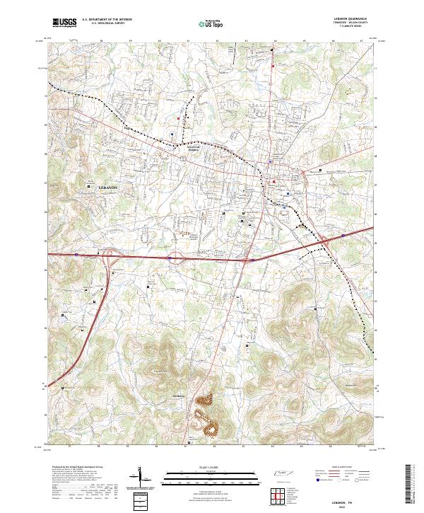
2022 Map of Lebanon
USGS Topo · Published 2022About this map
Lebanon serves as the focal point of this Tennessee landscape, anchored by the historic campus of Cumberland University and the administrative hub of the Wilson County Judicial Center. The city's growth is traced through neighborhoods like West End Heights and the outlying community of Egan, while the southern reaches transition into the prominent elevations of Fourmile Hill and Seay Hill. This contemporary survey illustrates a complex network of suburban expansion integrated with the older agricultural fabric of Wilson County.
Find a feature on this map
235 named features on this map. Tap any name to fly to it.
Don’t see what you’re looking for? This feature index may not catch every label — zoom into the map to look around manually.
Map Details
Editions of this 2022 Lebanon Map
This is the sole edition of this map. No revisions or reprints were ever made.
Other maps of this area

1942 · Statesville
USGS Topo · 1:100,000

1942 · Gallatin
USGS Topo · 1:100,000

1942 · Lebanon
USGS Topo · 1:100,000

1951 · Lebanon
USGS Topo · 1:24,000

1951 · Martha
USGS Topo · 1:24,000

1955 · Laguardo
USGS Topo · 1:24,000

1955 · Hunters Point
USGS Topo · 1:24,000

1956 · Vine
USGS Topo · 1:24,000

1956 · Gladeville
USGS Topo · 1:24,000

1956 · Nashville
USGS Topo · 1:250,000