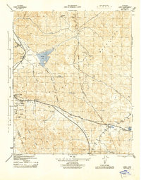
1945 Map of Lebec
USGS Topo · Published 1945About this map
The San Andreas Rift Valley cuts a prominent northwest-to-southeast path across this mid-1940s survey of the mountain passes between the Central Valley and Southern California. This corridor serves as the primary artery for transportation, carrying the winding route of highway 99 through Castaic Valley and past the settlement of Lebec. The map captures the infrastructure of the era, including the California Southern Edison Transmission Line and the LA-SF Airway Beacon, critical for early aviation navigation along this treacherous mountain route.
Find a feature on this map
30 named features on this map. Tap any name to fly to it.
Don’t see what you’re looking for? This feature index may not catch every label — zoom into the map to look around manually.
Map Details
Editions of this 1945 Lebec Map
This is the sole edition of this map. No revisions or reprints were ever made.
Other maps of this area

1903 · Tejon
USGS Topo · 1:125,000

1933 · Quail
USGS Topo · 1:24,000

1933 · Gorman
USGS Topo · 1:24,000

1938 · Gorman
USGS Topo · 1:24,000

1938 · Quail
USGS Topo · 1:24,000

1942 · Tecuya Creek
USGS Topo · 1:24,000

1942 · Frazier Mountain
USGS Topo · 1:24,000

1943 · Neenach
USGS Topo · 1:62,500
1944 · Frazier Mountain
USGS Topo · 1:31,680
1945 · Pastoria Creek
USGS Topo · 1:31,680