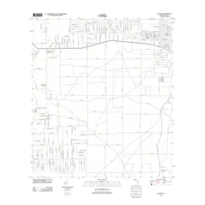
2012 Map of Lecanto
USGS Topo · Published 2012About this map
Lecanto Cem and a nearby post office define the northern settlement pattern of this Citrus County landscape as it appeared in the early 21st century. The area is characterized by a dense grid of residential streets including W Grover Cleveland Blvd and S Lecanto Hwy, juxtaposed with an extensive network of numbered forest routes such as Trail 2, Trail 4, and Trail 8.
Find a feature on this map
85 named features on this map. Tap any name to fly to it.
Don’t see what you’re looking for? This feature index may not catch every label — zoom into the map to look around manually.
Map Details
Editions of this 2012 Lecanto Map
This is the sole edition of this map. No revisions or reprints were ever made.
Other maps of this area

1895 · Tsala Apopka
USGS Topo · 1:62,500

1954 · Lecanto
USGS Topo · 1:24,000

1954 · Homosassa
USGS Topo · 1:24,000

1954 · Holder
USGS Topo · 1:24,000

1954 · Crystal River
USGS Topo · 1:24,000

1954 · Brooksville NW
USGS Topo · 1:24,000

1954 · Nobleton
USGS Topo · 1:24,000

1954 · Tsala Apopka NE
USGS Topo · 1:24,000

1954 · Chassahowitzka
USGS Topo · 1:24,000

1954 · Inverness
USGS Topo · 1:24,000