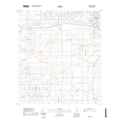
2021 Map of Lecanto
USGS Topo · Published 2021About this map
The settlement of Lecanto serves as a central hub in this contemporary study of Citrus County, where residential development meets the conservation lands of the Withlacoochee State Forest. This modern survey illustrates the expanding footprint of Inverness Highlands North and the presence of the College of Central Florida Citrus Campus, reflecting the area's growth as an educational and residential center. The landscape is characterized by its unique karst topography, featuring numerous depressions and water bodies such as Fivemile Pond, Mansfield Pond, and the aptly named Bull Sink. In the southeastern corner, the locale of Landrum marks a quieter transition near the forest boundary. For genealogists and local historians, the Lecanto Cem remains a critical landmark for tracing family roots in this part of Florida's Nature Coast.
Find a feature on this map
84 named features on this map. Tap any name to fly to it.
Don’t see what you’re looking for? This feature index may not catch every label — zoom into the map to look around manually.
Map Details
Editions of this 2021 Lecanto Map
This is the sole edition of this map. No revisions or reprints were ever made.
Other maps of this area

1895 · Tsala Apopka
USGS Topo · 1:62,500

1954 · Lecanto
USGS Topo · 1:24,000

1954 · Homosassa
USGS Topo · 1:24,000

1954 · Holder
USGS Topo · 1:24,000

1954 · Crystal River
USGS Topo · 1:24,000

1954 · Brooksville NW
USGS Topo · 1:24,000

1954 · Nobleton
USGS Topo · 1:24,000

1954 · Tsala Apopka NE
USGS Topo · 1:24,000

1954 · Chassahowitzka
USGS Topo · 1:24,000

1954 · Inverness
USGS Topo · 1:24,000