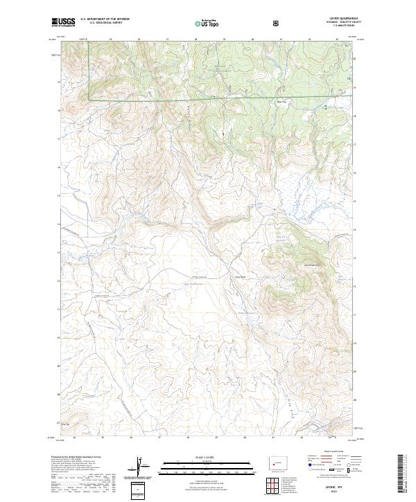
2023 Map of Leckie
USGS Topo · Published 2023About this map
Lander Cutoff Rd traverses the central portion of this landscape, marking a historic corridor of western migration through Sublette County. This 2023 survey illustrates how the contemporary road network follows these legacy paths, crossing the winding Big Sandy River and its numerous tributaries including Dutch Joe Creek and Sagebrush Creek. The northern reaches are dominated by the Bridger National Forest, where features like Bear Trap and Muddy Ridge define the high country drainage patterns. Water management is a primary characteristic of the local geography, evidenced by several strategically placed catchments such as Blue Pit Reservoir, Tally Pit Reservoir, and Zembo Reservoir. These features, along with Little Prospect Mtn and Flat Top, provide a detailed inventory of the area's modern land use and topography, from forest boundaries to remote grazing and water resources.
Find a feature on this map
25 named features on this map. Tap any name to fly to it.
Don’t see what you’re looking for? This feature index may not catch every label — zoom into the map to look around manually.
Map Details
Editions of this 2023 Leckie Map
This is the sole edition of this map. No revisions or reprints were ever made.
Other maps of this area

1955 · Lander
USGS Topo · 1:250,000

1958 · Lander
USGS Topo · 1:250,000

1958 · Parting of the Ways
USGS Topo · 1:62,500

1961 · Lander
USGS Topo · 1:250,000

1969 · Pocket Creek Lake
USGS Topo · 1:24,000

1969 · Leckie Reservoir
USGS Topo · 1:24,000

1969 · Leckie SW
USGS Topo · 1:24,000

1969 · Jensen Meadows
USGS Topo · 1:24,000

1969 · Tabernacle Butte
USGS Topo · 1:24,000
1969 · Big Sandy Opening
USGS Topo · 1:24,000