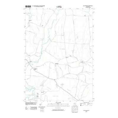
2010 Map of Lee Center
USGS Topo · Published 2010About this map
Lee Center and the surrounding hamlets of Oneida County are defined by a complex network of waterways feeding into the Mohawk Valley drainage system. In the early 21st century, this landscape remains a mix of rural residential pockets and significant natural features like the expansive Huckleberry Swamp and the Oneida City Reservoir. The map provides a detailed view of the transition from the upland terrain of Stace Hill down toward the creek-veined lowlands. Significant for local historians are the numerous burial grounds documented, including Maple Hill Cemetery near Taberg and the more remote Smith Cemetery to the northeast. Transportation patterns are anchored by routes such as Veterans Memorial Pkwy and Lee Center Taberg Rd, which connect the small clusters of Glenmore, West Lee, and Humaston. The presence of the Becks Grove Airport and Leisure Village indicates the modern evolution of land use in this traditionally agricultural and forested region.
Find a feature on this map
70 named features on this map. Tap any name to fly to it.
Don’t see what you’re looking for? This feature index may not catch every label — zoom into the map to look around manually.
Map Details
Editions of this 2010 Lee Center Map
This is the sole edition of this map. No revisions or reprints were ever made.
Other maps of this area

1895 · Oriskany
USGS Topo · 1:62,500

1895 · Oneida
USGS Topo · 1:62,500

1898 · Oneida
USGS Topo · 1:62,500

1898 · Oriskany
USGS Topo · 1:62,500

1902 · Oneida
USGS Topo · 1:62,500

1904 · Boonville
USGS Topo · 1:62,500

1905 · Taberg
USGS Topo · 1:62,500

1939 · Oneida
USGS Topo · 1:62,500

1943 · East Florence
USGS Topo · 1:31,680

1943 · Camden East
USGS Topo · 1:31,680