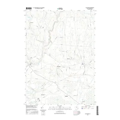
2016 Map of Lee Center
USGS Topo · Published 2016About this map
Taberg and Lee Center anchor this rural landscape in the northern reaches of Rome. The terrain is defined by the complex drainage of East Branch Fish Creek and Canada Cr, with several small reservoirs like the Oneida City Reservoir and the City of Rome Reservoir situated among the drumlin-like hills. Long-established hamlets and crossroads such as Glenmore, West Lee, and Humaston are connected by a network of named country roads, including Coal Hill Rd and Frenchtown Rd. Small family or community burial grounds, such as Eames Cem and Smith Cem, are scattered across the quadrangle, reflecting the area's agricultural and genealogical depth. Toward the south, the landscape transitions into the significant wetland of Huckleberry Swamp, while the Becks Grove Airport indicates modern land use near Becks Grove.
Find a feature on this map
90 named features on this map. Tap any name to fly to it.
Don’t see what you’re looking for? This feature index may not catch every label — zoom into the map to look around manually.
Map Details
Editions of this 2016 Lee Center Map
This is the sole edition of this map. No revisions or reprints were ever made.
Other maps of this area

1895 · Oriskany
USGS Topo · 1:62,500

1895 · Oneida
USGS Topo · 1:62,500

1898 · Oneida
USGS Topo · 1:62,500

1898 · Oriskany
USGS Topo · 1:62,500

1902 · Oneida
USGS Topo · 1:62,500

1904 · Boonville
USGS Topo · 1:62,500

1905 · Taberg
USGS Topo · 1:62,500

1939 · Oneida
USGS Topo · 1:62,500

1943 · East Florence
USGS Topo · 1:31,680

1943 · Camden East
USGS Topo · 1:31,680