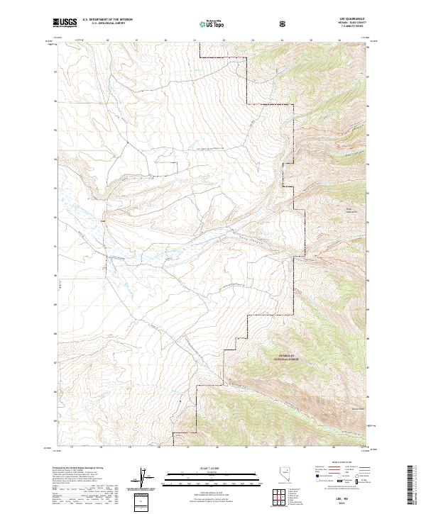
2021 Map of Lee
USGS Topo · Published 2021About this map
The Lee settlement sits at the base of the western Ruby Mountains slopes, where the S Fork Humboldt River emerges from the high drainage basins of the Humboldt National Forest. This region is defined by deep geological incisions including Echo Canyon and Box Canyon, which drain westward toward the valley floor. The landscape is structured by a network of historic trails and forest roads that trace the rugged topography, such as the Kleckner Creek Trl and Rattlesnake Creek Trl. High-altitude features like Drown Peak overlook a system of seasonal and perennial waters, including Lee Spring and Hale Cr. The map details the transition from the high alpine environment of the national forest down to the river-fed lands surrounding the community of Lee.
Find a feature on this map
42 named features on this map. Tap any name to fly to it.
Don’t see what you’re looking for? This feature index may not catch every label — zoom into the map to look around manually.
Map Details
Editions of this 2021 Lee Map
This is the sole edition of this map. No revisions or reprints were ever made.
Other maps of this area

1934 · Jiggs
USGS Topo · 1:125,000

1935 · Halleck
USGS Topo · 1:125,000

1937 · Jiggs
USGS Topo · 1:125,000

1955 · Elko
USGS Topo · 1:250,000

1958 · Elko
USGS Topo · 1:250,000

1959 · Jiggs
USGS Topo · 1:62,500

1962 · Elko
USGS Topo · 1:250,000

1962 · Lee
USGS Topo · 1:62,500

1962 · Lamoille
USGS Topo · 1:62,500

1965 · Elko
USGS Topo · 1:250,000