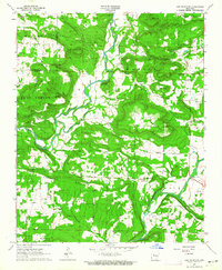
1963 Map of Lee Mountain
USGS Topo · Published 1964About this map
Piney Creek winds through the heart of this landscape, separating the high ridges of Higkey Mountain and Martin Mountain from the southern peaks of Augsburg Mountain and Bayliss Mountain. The area is defined by its deep hollows and namesake summits, with the small community of Piney situated along the creek near Parker Mountain. Early settlement patterns are revealed through numerous family-named burial sites such as Adams Cem and Lindzy Cem, alongside rural congregations like Pleasant Grove Ch and the House of Prayer Ch. Evidence of early natural resource extraction appears in the form of several Gas Wells and a Gas Well north of Augsburg, while the eastern boundary is marked by the course of the Illinois Bayou and Linker Creek.
Find a feature on this map
39 named features on this map. Tap any name to fly to it.
Don’t see what you’re looking for? This feature index may not catch every label — zoom into the map to look around manually.
Map Details
Editions of this 1963 Lee Mountain Map
2 editions found
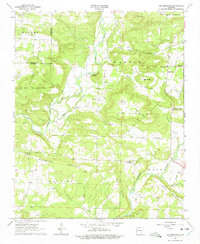
Other maps of this area

1888 · Dardanelle #2
USGS Topo · 1:62,500

1888 · Dardanelle #1
USGS Topo · 1:62,500

1889 · Treat
USGS Topo · 1:62,500

1889 · Ozone
USGS Topo · 1:62,500

1890 · Dardanelle
USGS Topo · 1:125,000

1932 · Treat
USGS Topo · 1:62,500

1934 · Treat
USGS Topo · 1:62,500

1934 · Ozone
USGS Topo · 1:62,500

1936 · Ozone
USGS Topo · 1:62,500

1956 · Russellville
USGS Topo · 1:250,000