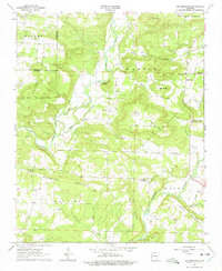
1963 Map of Lee Mountain
USGS Topo · Published 1975About this map
The confluence of Big Piney Creek and Piney Creek anchors this mid-century survey of the Pope County highlands. The landscape is defined by its ridge-and-valley topography, where small settlements like Augsburg and Piney occupy the narrow corridors between Lee Mountain and Augsburg Mountain. The region’s cultural history is mapped through its numerous rural congregations, including the Pleasant Grove Ch and Cumberland Ch, which served as the social hubs for these isolated mountain communities.
Find a feature on this map
44 named features on this map. Tap any name to fly to it.
Don’t see what you’re looking for? This feature index may not catch every label — zoom into the map to look around manually.
Map Details
Editions of this 1963 Lee Mountain Map
2 editions found
Other maps of this area

1888 · Dardanelle #2
USGS Topo · 1:62,500

1888 · Dardanelle #1
USGS Topo · 1:62,500

1889 · Treat
USGS Topo · 1:62,500

1889 · Ozone
USGS Topo · 1:62,500

1890 · Dardanelle
USGS Topo · 1:125,000

1932 · Treat
USGS Topo · 1:62,500

1934 · Treat
USGS Topo · 1:62,500

1934 · Ozone
USGS Topo · 1:62,500

1936 · Ozone
USGS Topo · 1:62,500

1956 · Russellville
USGS Topo · 1:250,000