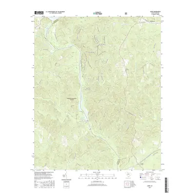
2017 Map of Leeds
USGS Topo · Published 2017About this map
The Broad River carves a deep path through the heart of this Piedmont landscape, forming the boundary between Union and Chester counties. Much of the western terrain is preserved within the Sumter National Forest, characterized by numerous drainages such as Browns Creek and Neals Cr. The river itself is punctuated by the Neal Shoals Reservoir, a significant water feature that anchors the central portion of the map. Evidence of early settlement and family legacy is found in several rural burial sites, including Thomas Cem, Sims Cem, and Glenn Cem, which are scattered among the wooded hills.
Find a feature on this map
53 named features on this map. Tap any name to fly to it.
Don’t see what you’re looking for? This feature index may not catch every label — zoom into the map to look around manually.
Map Details
Editions of this 2017 Leeds Map
This is the sole edition of this map. No revisions or reprints were ever made.
Other maps of this area

1907 · Sharon
USGS Topo · 1:62,500

1941 · Spartanburg
USGS Topo · 1:250,000

1953 · Spartanburg
USGS Topo · 1:250,000

1960 · Spartanburg
USGS Topo · 1:250,000

1963 · Spartanburg
USGS Topo · 1:250,000

1964 · Spartanburg
USGS Topo · 1:250,000
1969 · Carlisle
USGS Topo · 1:24,000

1969 · Kelton
USGS Topo · 1:24,000

1969 · Baton Rouge
USGS Topo · 1:24,000
1969 · Carlisle SE
USGS Topo · 1:24,000