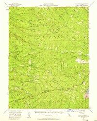
1951 Map of Leek Spring Hill
USGS Topo · Published 1958About this map
Eldorado National Forest defines the rugged character of this Sierra Nevada landscape, where the North Fork Cosumnes River and its various forks carve through high ridges. By the early 1950s, the region's industrial past is clearly marked by several inactive locations, including the Girard Mill (Site), Plum Creek Mill (Site), and Tuman Mill (Site), signaling a shift from early timber operations. The map documents the infrastructure of forest management and early tourism, featuring the Caldor Ranger Sta and the waypoint at Hams Station. Mining history is preserved through labels like the Spread Eagle Mine and Robert Lee Mine, while the Logging Road network and Telephone Line trace the development of the high country. From the heights of Leek Spring Hill to the seasonal reaches of Elkins Flat, this survey captures the intersection of resource extraction and the remote backcountry of the western Sierra slopes.
Find a feature on this map
106 named features on this map. Tap any name to fly to it.
Don’t see what you’re looking for? This feature index may not catch every label — zoom into the map to look around manually.
Map Details
Editions of this 1951 Leek Spring Hill Map
3 editions found
Other maps of this area

1889 · Jackson
USGS Topo · 1:125,000

1889 · Pyramid Peak
USGS Topo · 1:125,000

1891 · Big Trees
USGS Topo · 1:125,000

1891 · Placerville
USGS Topo · 1:125,000

1891 · Pyramid Peak
USGS Topo · 1:125,000

1892 · Jackson
USGS Topo · 1:125,000

1892 · Placerville
USGS Topo · 1:125,000

1893 · Placerville
USGS Topo · 1:125,000

1894 · Big Trees
USGS Topo · 1:125,000

1895 · Pyramid Peak
USGS Topo · 1:125,000