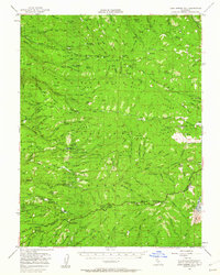
1951 Map of Leek Spring Hill
USGS Topo · Published 1962About this map
Eldorado National Forest encompasses this mid-century landscape where industry and infrastructure meet the Sierra Nevada foothills. The mapping of this era highlights a transition from early timber and mineral extraction toward forest management, evidenced by the numerous fire prevention and monitoring sites such as the Leon Fire Tank, Harrel Fire Tank, and the Iron Mtn Lookout. The lumber industry's footprint is clear, with several historical milling locations documented, including the Girard Mill (Site) and Tuman Mill (Site), alongside active logging routes and the Caldor Ranger Sta.
Find a feature on this map
138 named features on this map. Tap any name to fly to it.
Don’t see what you’re looking for? This feature index may not catch every label — zoom into the map to look around manually.
Map Details
Editions of this 1951 Leek Spring Hill Map
3 editions found
Other maps of this area

1889 · Jackson
USGS Topo · 1:125,000

1889 · Pyramid Peak
USGS Topo · 1:125,000

1891 · Big Trees
USGS Topo · 1:125,000

1891 · Placerville
USGS Topo · 1:125,000

1891 · Pyramid Peak
USGS Topo · 1:125,000

1892 · Jackson
USGS Topo · 1:125,000

1892 · Placerville
USGS Topo · 1:125,000

1893 · Placerville
USGS Topo · 1:125,000

1894 · Big Trees
USGS Topo · 1:125,000

1895 · Pyramid Peak
USGS Topo · 1:125,000