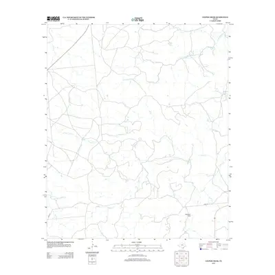
2012 Map of Leeper Creek
USGS Topo · Published 2012About this map
Leeper Cr and its many tributaries define the hydrology of this Shackelford County landscape, where the drainage patterns of north-central Texas are revealed in high detail. The map shows the winding course of Salt Prong Hubbard Cr as it moves through the northern sections, while Deadman Draw creates a distinct topographical feature to the southeast. The area is characterized by its rural isolation, marked primarily by watercourses like Long Cr and S Prong Long Cr. Sparse infrastructure is limited to a few local routes, such as Co RD 190 and Co RD 109, which provide access to the remote ranchlands. This survey illustrates the relationship between the ephemeral creek beds and the vast, open country of the Texas plains, offering a precise look at the terrain before modern development altered these traditional drainage basins.
Find a feature on this map
9 named features on this map. Tap any name to fly to it.
Don’t see what you’re looking for? This feature index may not catch every label — zoom into the map to look around manually.
Map Details
Editions of this 2012 Leeper Creek Map
This is the sole edition of this map. No revisions or reprints were ever made.
Other maps of this area

1890 · Abilene
USGS Topo · 1:125,000

1891 · Anson
USGS Topo · 1:125,000

1892 · Abilene
USGS Topo · 1:125,000

1892 · Albany
USGS Topo · 1:125,000

1893 · Albany
USGS Topo · 1:125,000

1893 · Anson
USGS Topo · 1:125,000

1931 · Baird
USGS Topo · 1:125,000

1932 · Baird
USGS Topo · 1:125,000

1954 · Abilene
USGS Topo · 1:250,000

1957 · Kirby Lake
USGS Topo · 1:62,500