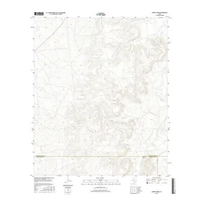
2016 Map of Leeper Creek
USGS Topo · Published 2016About this map
The rolling ranchlands of the Texas Big Country are defined here by a network of drainage basins straddling the Shackelford Co and Callahan Co line. The terrain is characterized by intricate contouring around watercourses like Salt Prong Hubbard Cr and the map's namesake, Leeper Cr. These seasonal and perennial streams create a rugged topography, particularly visible around Deadman Draw and the various branches of Long Cr. Evidence of modern water management appears with Vanzandt Lake Number 2 in the northeast, while the human footprint remains sparse, limited primarily to rural routes such as Co RD 190. This survey offers a clear view of the natural hydrology that has dictated land use in this part of West Texas for generations, showing how cattle and land were managed before further modern encroachment.
Find a feature on this map
10 named features on this map. Tap any name to fly to it.
Don’t see what you’re looking for? This feature index may not catch every label — zoom into the map to look around manually.
Map Details
Editions of this 2016 Leeper Creek Map
This is the sole edition of this map. No revisions or reprints were ever made.
Other maps of this area

1890 · Abilene
USGS Topo · 1:125,000

1891 · Anson
USGS Topo · 1:125,000

1892 · Abilene
USGS Topo · 1:125,000

1892 · Albany
USGS Topo · 1:125,000

1893 · Albany
USGS Topo · 1:125,000

1893 · Anson
USGS Topo · 1:125,000

1931 · Baird
USGS Topo · 1:125,000

1932 · Baird
USGS Topo · 1:125,000

1954 · Abilene
USGS Topo · 1:250,000

1957 · Kirby Lake
USGS Topo · 1:62,500