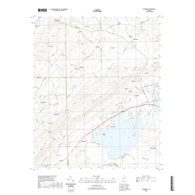
2020 Map of Leesburg
USGS Topo · Published 2020About this map
Weiss Lake and its intricate shoreline at Tillery Cove dominate the southern portion of this region, where the Coosa River winds through Ballplay Bend. The landscape is defined by the sharp elevation of Lookout Mountain and the parallel corridor of Shinbone Valley, which is flanked by the prominent Shinbone Ridge. This area shows a transition from the agricultural lowlands near Leesburg and Slackland to the higher elevations of the Cumberland Plateau.
Find a feature on this map
139 named features on this map. Tap any name to fly to it.
Don’t see what you’re looking for? This feature index may not catch every label — zoom into the map to look around manually.
Map Details
Editions of this 2020 Leesburg Map
This is the sole edition of this map. No revisions or reprints were ever made.
Other maps of this area

1893 · Fort Payne
USGS Topo · 1:125,000

1898 · Fort Payne
USGS Topo · 1:125,000

1900 · Fort Payne
USGS Topo · 1:125,000

1936 · Crossville
USGS Topo · 1:24,000

1936 · Roden Gap
USGS Topo · 1:24,000

1946 · Portersville
USGS Topo · 1:24,000
1947 · Portersville
USGS Topo · 1:24,000
1949 · Crossville
USGS Topo · 1:24,000

1955 · Rome
USGS Topo · 1:250,000

1958 · Rome
USGS Topo · 1:250,000