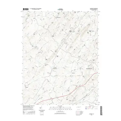
2016 Map of Leesburg
USGS Topo · Published 2016About this map
Jonesborough, Tennessee's oldest town, anchors the eastern edge of this modern survey, which details a landscape of enduring agricultural and religious heritage in Washington County. The settlement patterns of the 19th and early 20th centuries are still clearly legible in the many community clusters like Leesburg, Telford, and Bowmantown. Genealogists will find a high density of burial grounds and rural houses of worship, including the Bowmantown-Philadelphia Cemetery, Philadelphia Church, and the Mount Zion Church. High ground is defined by distinct landforms such as Allegheny Ridge and Mitchell Ridge, while the drainage of Big Limestone Creek and Muddy Fork provided the water power for early industry at sites like Taylor Mill and Keys Mill. This map offers a precise contemporary look at how the region's historical road network, featuring routes like the Old Stagecoach Road, continues to shape the modern geography of East Tennessee.
Find a feature on this map
216 named features on this map. Tap any name to fly to it.
Don’t see what you’re looking for? This feature index may not catch every label — zoom into the map to look around manually.
Map Details
Editions of this 2016 Leesburg Map
This is the sole edition of this map. No revisions or reprints were ever made.
Other maps of this area

1891 · Roan Mountain
USGS Topo · 1:125,000

1892 · Greeneville
USGS Topo · 1:125,000

1894 · Roan Mountain
USGS Topo · 1:125,000

1896 · Greeneville
USGS Topo · 1:125,000

1904 · Roan Mountain
USGS Topo · 1:125,000

1904 · Greeneville
USGS Topo · 1:125,000

1935 · Lovelace
USGS Topo · 1:24,000

1935 · Sullivan Gardens
USGS Topo · 1:24,000

1935 · Leesburg
USGS Topo · 1:24,000

1935 · Erwin
USGS Topo · 1:24,000