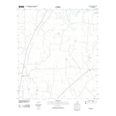
2010 Map of Leesville
USGS Topo · Published 2010About this map
The Guadalupe River carves its way through the northern reaches of this rural landscape, feeding into Lake Gonzales at the northeast corner. This Texas terrain is defined by its deep genealogical roots, visible in the high density of family and community burial grounds scattered across the countryside. From the Ellis- Nance Cemetery and Stroman Cemetery in the north to the Askey Cemetery and Antioch Cemetery further south, these sites suggest a long history of generational settlement near the banks of Burroughs Creek and Dullnig Creek.
Find a feature on this map
53 named features on this map. Tap any name to fly to it.
Don’t see what you’re looking for? This feature index may not catch every label — zoom into the map to look around manually.
Map Details
Editions of this 2010 Leesville Map
This is the sole edition of this map. No revisions or reprints were ever made.
Other maps of this area

1911 · San Marcos
USGS Topo · 1:125,000

1919 · San Marcos
USGS Topo · 1:125,000

1920 · Smiley
USGS Topo · 1:125,000

1924 · San Marcos 3-d
USGS Topo · 1:48,000

1925 · San Marcos 4-c
USGS Topo · 1:48,000

1929 · Luling
USGS Topo · 1:62,500

1930 · Seguin
USGS Topo · 1:62,500

1942 · Dewville
USGS Topo · 1:62,500

1953 · Seguin
USGS Topo · 1:250,000

1956 · Dewville
USGS Topo · 1:62,500