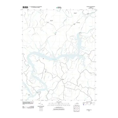
2010 Map of Leesville
USGS Topo · Published 2010About this map
Leesville Lake dominates this 2010 landscape, where the Roanoke River is impounded by the Leesville Dam at the community of Leesville. The map captures the interface of water-based recreation and older agrarian footprints, such as Coles Quarter and the Stone Road Cemetery. Significant elevations like Stone Road Mountain and King George Mountain overlook a network of waterways including Stony Creek and Meadow Branch.
Find a feature on this map
66 named features on this map. Tap any name to fly to it.
Don’t see what you’re looking for? This feature index may not catch every label — zoom into the map to look around manually.
Map Details
Editions of this 2010 Leesville Map
This is the sole edition of this map. No revisions or reprints were ever made.
Other maps of this area

1890 · Roanoke
USGS Topo · 1:125,000

1891 · Roanoke
USGS Topo · 1:125,000

1892 · Lynchburg
USGS Topo · 1:125,000

1921 · Chatham
USGS Topo · 1:48,000

1922 · Callands
USGS Topo · 1:48,000

1923 · Chatham
USGS Topo · 1:62,500

1924 · Callands
USGS Topo · 1:62,500

1944 · Callands
USGS Topo · 1:62,500

1947 · Roanoke
USGS Topo · 1:250,000

1951 · Moneta
USGS Topo · 1:62,500