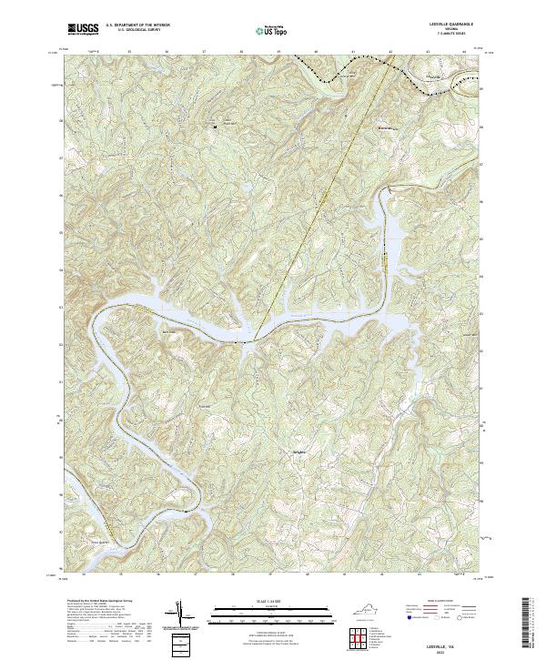
2022 Map of Leesville
USGS Topo · Published 2022About this map
Leesville and Browntown sit at the northern edge of this Piedmont landscape, where the Roanoke River carves a deep, winding path through the borderlands of Pittsylvania, Campbell, and Bedford counties. The terrain is defined by prominent elevations such as Stone Road Mtn, Bald Knob, and King George Mtn, which overlook a complex network of tributaries including Goose Creek, Terrapin Creek, and McDaniels Cr.
Find a feature on this map
119 named features on this map. Tap any name to fly to it.
Don’t see what you’re looking for? This feature index may not catch every label — zoom into the map to look around manually.
Map Details
Editions of this 2022 Leesville Map
This is the sole edition of this map. No revisions or reprints were ever made.
Other maps of this area

1890 · Roanoke
USGS Topo · 1:125,000

1891 · Roanoke
USGS Topo · 1:125,000

1892 · Lynchburg
USGS Topo · 1:125,000

1921 · Chatham
USGS Topo · 1:48,000

1922 · Callands
USGS Topo · 1:48,000

1923 · Chatham
USGS Topo · 1:62,500

1924 · Callands
USGS Topo · 1:62,500

1944 · Callands
USGS Topo · 1:62,500

1947 · Roanoke
USGS Topo · 1:250,000

1951 · Moneta
USGS Topo · 1:62,500