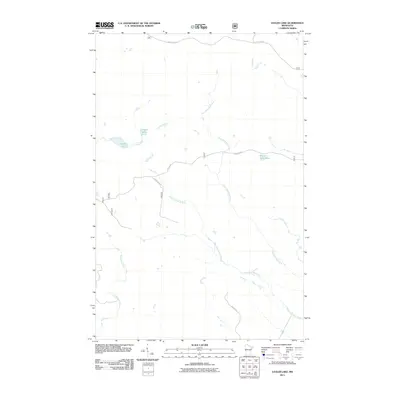
2011 Map of Legler Lake
USGS Topo · Published 2011About this map
The headwaters of the North Shore's drainage basins define this portion of Lake County, where the terrain transitions between the Superior National Forest and the coastal highlands. The hydrology is dominated by the Gooseberry River in the southwest and the branching systems of the East Split Rock River and West Split Rock River to the east. These waterways are interspersed with relatively isolated basins such as Legler Lake and the smaller Water Tank Lake. A network of unpaved forest access routes, including Kane Lk Rd and Forest Rte 397, provides the primary infrastructure through this timber and wetland landscape. This survey illustrates the protected character of the region, where naming conventions like Langley Lake and Langley River suggest early local land use within the township forest.
Find a feature on this map
11 named features on this map. Tap any name to fly to it.
Don’t see what you’re looking for? This feature index may not catch every label — zoom into the map to look around manually.
Map Details
Editions of this 2011 Legler Lake Map
This is the sole edition of this map. No revisions or reprints were ever made.
Other maps of this area

1953 · Whyte
USGS Topo · 1:62,500

1954 · Silver Bay
USGS Topo · 1:62,500

1954 · Two Harbors
USGS Topo · 1:250,000

1956 · Split Rock Point
USGS Topo · 1:24,000

1956 · Split Rock Point
USGS Topo · 1:62,500

1957 · Two Harbors
USGS Topo · 1:250,000

1957 · Two Harbors
USGS Topo · 1:62,500

1957 · Two Harbors NE
USGS Topo · 1:24,000

1958 · Two Harbors
USGS Topo · 1:250,000

1964 · Two Harbors
USGS Topo · 1:250,000