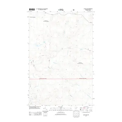
2013 Map of Legler Lake
USGS Topo · Published 2013About this map
The Superior National Forest dominates this landscape in Silver Creek Township, defined by a dense network of tributaries and small glacial lakes. The Gooseberry River flows through the southwest corner, while the E Split Rock River and W Split Rock River carve paths through the central and eastern sections. In the north, Norshor Junction serves as a lone named waypoint along Co Hwy 15, marking a transition in this wooded terrain. Isolated water bodies like Legler Lake, Langley Lake, and the descriptively named Water Tank Lake are connected by forest roads such as Kane Lk Rd and Bear Pit Rd, illustrating the intersection of natural hydrology and managed timberland access in the early 21st century.
Find a feature on this map
13 named features on this map. Tap any name to fly to it.
Don’t see what you’re looking for? This feature index may not catch every label — zoom into the map to look around manually.
Map Details
Editions of this 2013 Legler Lake Map
This is the sole edition of this map. No revisions or reprints were ever made.
Other maps of this area

1953 · Whyte
USGS Topo · 1:62,500

1954 · Silver Bay
USGS Topo · 1:62,500

1954 · Two Harbors
USGS Topo · 1:250,000

1956 · Split Rock Point
USGS Topo · 1:24,000

1956 · Split Rock Point
USGS Topo · 1:62,500

1957 · Two Harbors
USGS Topo · 1:250,000

1957 · Two Harbors
USGS Topo · 1:62,500

1957 · Two Harbors NE
USGS Topo · 1:24,000

1958 · Two Harbors
USGS Topo · 1:250,000

1964 · Two Harbors
USGS Topo · 1:250,000