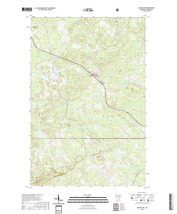
2022 Map of Legler Lake
USGS Topo · Published 2022About this map
Superior National Forest defines the character of this northern landscape, where a dense network of waterways feeds into the Lake Superior watershed. The area is anchored by Legler Lake and Langley Lake in the northwest, with the Langley River and the headwaters of the Gooseberry River winding through the timberland. Further east, the E Split Rock River and W Split Rock River drain southward toward the Great Lake shore.
Find a feature on this map
24 named features on this map. Tap any name to fly to it.
Don’t see what you’re looking for? This feature index may not catch every label — zoom into the map to look around manually.
Map Details
Editions of this 2022 Legler Lake Map
This is the sole edition of this map. No revisions or reprints were ever made.
Other maps of this area

1953 · Whyte
USGS Topo · 1:62,500

1954 · Silver Bay
USGS Topo · 1:62,500

1954 · Two Harbors
USGS Topo · 1:250,000

1956 · Split Rock Point
USGS Topo · 1:24,000

1956 · Split Rock Point
USGS Topo · 1:62,500

1957 · Two Harbors
USGS Topo · 1:250,000

1957 · Two Harbors
USGS Topo · 1:62,500

1957 · Two Harbors NE
USGS Topo · 1:24,000

1958 · Two Harbors
USGS Topo · 1:250,000

1964 · Two Harbors
USGS Topo · 1:250,000