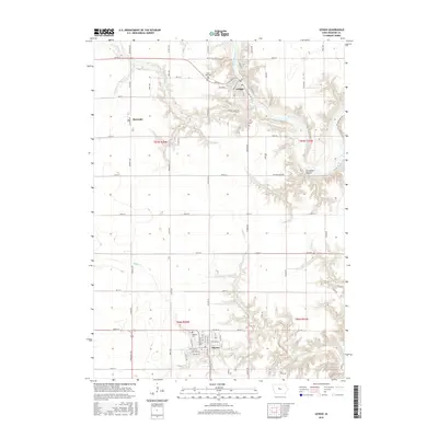
2015 Map of Lehigh
USGS Topo · Published 2015About this map
The Des Moines River carves a deep path through Webster County, creating a distinct break in the flat prairie landscape of central Iowa. The settlement of Lehigh sits prominently on the river's eastern bend, where a network of local streets like E Main St and Spencer Hill St meet the water. To the south, the town of Dayton anchors the township, surrounded by several smaller burial grounds that provide valuable touchpoints for family history research, including Dayton Cemetery and Low Cemetery.
Find a feature on this map
66 named features on this map. Tap any name to fly to it.
Don’t see what you’re looking for? This feature index may not catch every label — zoom into the map to look around manually.
Map Details
Editions of this 2015 Lehigh Map
This is the sole edition of this map. No revisions or reprints were ever made.
Other maps of this area

1916 · Boone
USGS Topo · 1:62,500

1923 · Lehigh
USGS Topo · 1:62,500

1951 · Ogden
USGS Topo · 1:62,500

1954 · Waterloo
USGS Topo · 1:250,000

1954 · Fort Dodge
USGS Topo · 1:250,000

1955 · Waterloo
USGS Topo · 1:250,000

1957 · Fort Dodge
USGS Topo · 1:250,000

1958 · Fort Dodge
USGS Topo · 1:250,000

1965 · Fraser
USGS Topo · 1:24,000

1965 · Fort Dodge South
USGS Topo · 1:24,000